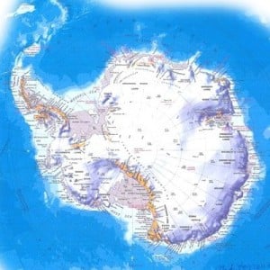
 Nowadays, it seems as if most of the world has been mapped and all unknown lands visited. However, the cold and inhospitable land known as Antarctica has always seemed a bit mysterious to most of us. Recently NASA announced in a press release that it has “created the first complete map of the speed and direction of ice flow in Antarctica.”
Creating the map took a lot of effort and time. Using radar and a collection of international satellites, Eric Rignot, Jeremie Mouginot, and Bernd Scheuchl, scientists from UC-Irvine, “used billions of data points captured by European, Japanese and Canadian satellites to weed out cloud cover, solar glare and land features masking the glaciers. With the aid of NASA technology, the team painstakingly pieced together the shape and velocity of glacial formations, including the previously uncharted East Antarctica, which comprises 77 percent of the continent.”
The scientists discovered a new ridge between the 5.4 million square miles of land between East and West Antarctica and unknown formations of land that move 800 ft. ever year towards the Antarctic Ocean. The findings will give these scientists plenty of data to pore over, including “tracking future sea-level increases from climate change.”
Check out the map for yourself:


Leave a Reply